"LEDLENSER P5.2" has been added to your enquiry.
View Enquiry
-
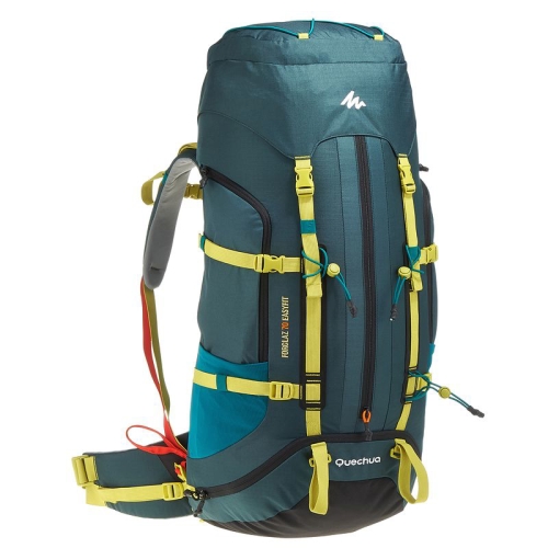
men several days hiking, whatever the weather. lightweight, fits in six multi-day hikes, medium weight equipment transportation. The EasyFit system recorded the backpack can be adjusted to fit properly.
-
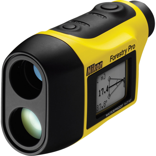
The Forestry Pro is the enhanced model of the Forestry 550 Laser Rangefinder. This widely used and praised forestry industry specific laser rangefinder is now equipped with three-point measurement capability to meet market demands. This newly added function enables a user to obtain the height of a tree even when the top or base of a tree is blocked by branches or bushes, preventing the use of conventional separation measurement where the laser beam is required to reach those points.
• Three-point measurement function:
• The height of a tree is calculated using the horizontal distance and angles of both the top and base of the tree.
• Easy operation enables measurement of actual distance, horizontal distance and height.
• Target Priority Switch System offers two measurement modes:
• Distant Target Priority mode displays the range to the farthest target among multiple results obtained with a single measurement.
• First Target Priority mode displays the range to the nearest target among multiple results obtained with a single measurement.
• The results are displayed on both internal and external LCD panels. The external panel displays all results simultaneously.
• High-quality 6x monocular with multilayer coating for bright images.
• High-eyepoint design affords eyeglass wearers easy viewing.
• Capable of distancing different targets in succession, for up to 20 seconds, by keeping the button pressed.
• Waterproof (up to 1 meter for 10 minutes), but not designed for underwater usage; battery chamber is water-resistant.
• Measurement range: 10-500 m / 11-550 yd. / 33-999 ft.
-
-

-
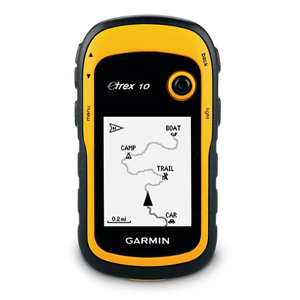
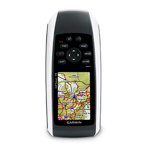
Handheld GPS with Enhanced Capabilities
Worldwide basemap
2.2" monochrome display, easy to read in any light
GPS and GLONASS satellites for faster positioning
Paperless geocaching
25-hour battery life with 2 AA batteries
-
-
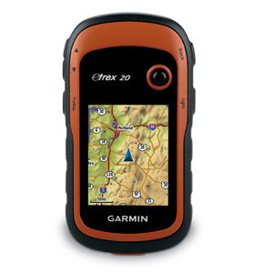
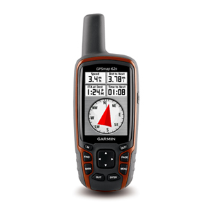
Our Most Popular Handheld GPS with 3-axis Compass
Worldwide basemap
2.2" 65K color, sunlight-readable display
3-axis compass and barometric altimeter
Wireless capability to share waypoints, routes and geocaches with other similar devices
GPS and GLONASS satellites for faster positioning
-
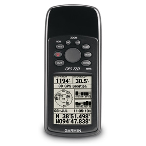
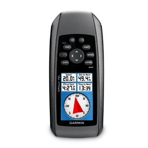
Make a splash with the GPS 72H, a lightweight, waterproof handheld that floats. Simple yet robust, the GPS 72H features high-sensitivity GPS and a USB connection along with its large screen, simple operation and rock-solid performance.
Acquire Satellites Quickly
Find your way effortlessly with the GPS 72H's high-sensitivity GPS receiver. GPS 72H acquires satellite signals quickly and tracks your location in challenging conditions, such as heavy tree cover or deep canyons.
Use on Land or Water
Don't worry about losing this GPS device in the drink. The GPS 72H floats in water, and it's IPX7 waterproof to withstand the accidental dunk or splash in the lake. Whether on water or land, the GPS 72H can save up to 500 of your favorite places in memory and point you to your destination (no street or terrain maps).
Store Important Data
The GPS 72H is NMEA 0183 compatible. To transfer data to your device, GPS 72H easily connects to your computer via USB. If you're into boating, hunting or fishing, you can use the 72H's built-in celestial data, which includes sunrise/sunset times and a hunting and fishing calendar.
-
-

-
-